Beara Peninsula and Kenmare on the Wild Atlantic Way
For our next leg of our trip around Ireland's Wild Atlantic Way, we left the town of Bantry and started on a tour around the Beara Peninsula. The Beara Peninsula is sometimes referred to as "Ireland's forgotten peninsula" - which as a description is way out of date! This part of the world is very much on the minds and plans of many of the people I know.


Now Reading:
Beara Peninsula and Kenmare on the Wild Atlantic Way
Our first stop was in the town of Castletownbere. It’s one of Ireland’s main fishing ports and is a busy little town and the commercial hub of the Beara Peninsula. We had to stop for a quick drink at the famous McCarthy’s Bar – made famous by appearing on the cover of a book by the same name by Pete McCarthy. One of the funniest books I have read – maybe you’ve read it already?

While McCarthy may feature over the top of the bar – this is an area of Ireland where you will find plenty of O’Sullivans! Just to the west of the town, we headed to see the remains of Dunboy Castle. This was one of the seats of Donal Cam O’Sullivan Beara – the clan leader of the Sullivan Beara in the late 16th century.

The O’Sullivans controlled the fisheries in the area and taxed all vessels sheltering in the haven.
In the summer of 1602 the O’Sullivans were rebelling against the English crown and George Carew was sent with a force of 5000 to suppress the rebels. Dunboy Castle was considered indestructible but after two weeks of bombardment, the castle was mostly destroyed.
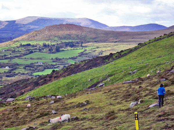
One of the nicest parts of the Beara Peninsula can be seen from the long distance path known as The Beara Way. It has to be one of the most beautiful hiking trails in the world – never too far from the mountains and the sea. The Peninsula is also covered with many prehistoric remains and the trail wanders nearby many of them. One of our favourite activities is spending a day doing a loop on part of the Beara Way – you come back a new person!
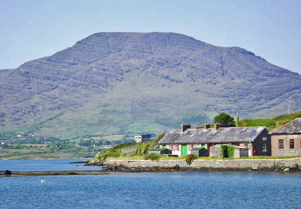
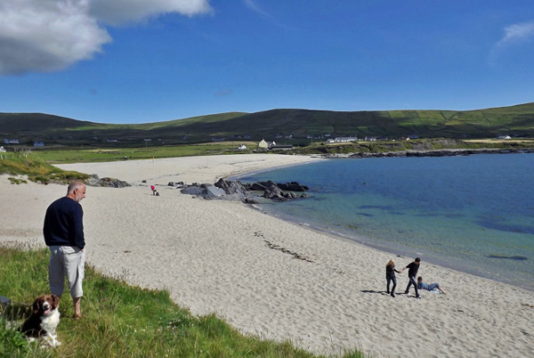
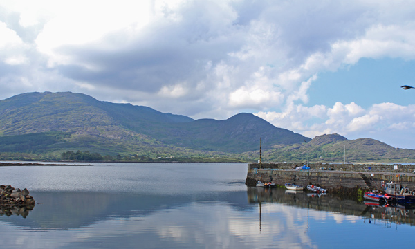
The mouth of Berehaven harbour is protected by Bere Island – served by ferry from the town of Castletownbere. Well worth a visit for an afternoon or an overnight.

Just a few miles beyond the town lies the very peaceful Buddhist Meditation centre of Dzogchen Beara – I have always been a fan of dropping in here and just contemplating the magnificent views for an hour or so. Nice preparation for what comes next at the end of the Peninsula!
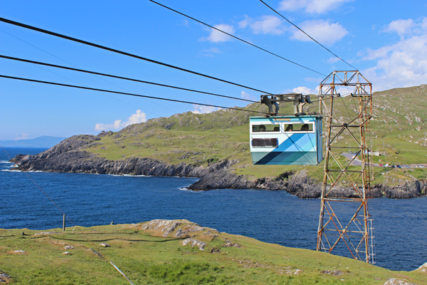
Dursey Island.
Dursey Island lies right at the end of the peninsula is the most southerly inhabited island in Ireland. As you can see, it is also serviced by a nicely exciting Cable Car – the only one in Europe to go over the open sea. Also, be aware that locals and their animals get to jump the queue of day tourists.
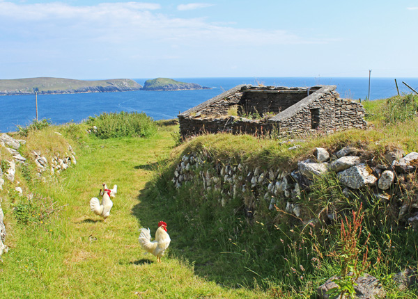
The full-time population of the island today is only six people – but there are plent of houses to rent in the summer. This is a walkers paradise – and the Beara Way stretches in a loop around the island. As you can see, on the day we were here it was a perfect day for both walking AND seeing everything. Somedays you may not be so lucky, with the rain and mist coming in from the south-west.
Rush Hour on Dursey Island
While there may only be a population of six today on this most peaceful of places – it was different in the past. For example, in 1602, it was place of final defence for the Beara O’Sullivans and a full three hundred of its inhabitants/soldiers were massacred on the island by English forces. By the end of that year, their chieftain Donal Cam O’Sullivan started a long march with many of the survivors to County Leitrim. Of the one thousand clan members that set out, only thirty five reached the final destination.

Walking above it all on Dursey
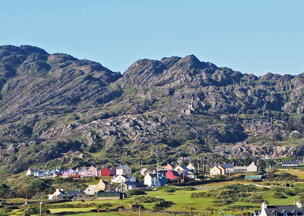
Allihies.
That evening we got the cable car back to the mainland and headed for our B and B before hitting the village of Allihies (or “Cluin” to give it it’s correct name). What a beauty! A pristine white beach – and a very colourful village set back up along the hill.

Driving down towards Allihies
From 1812 to 1912 this whole area was the site of one of the largest copper mines in the country. This industry led to two specific outcomes after it declined: 1) the large number of ruined engine houses and mine shafts in the area and 2) the number of experienced miners that headed to other parts of the world for work – many headed for the town of Butte in Montana in the USA.
The beautiful white beach at Allihies
For example, seventy-seven various families of Sullivans left this area back to Castletownbere to go to Butte. Apparently, by 1908 Butte had 1,200 Sullivans inside it’s jurisdiction.
The Village of Allihies
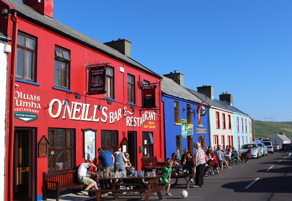
Settling down for the evening outside O’Neills
We ended up in O’Neills pub (and restaurant I might add) – but mostly spent our time out on the street in this lovely and lively village with an end-of-the-world (geographically) atmosphere. About as far as you can get from Cork city and still be in County Cork.
A view around every corner
If you look at the 1901 census, you’ll see the following family names in quantity for Allihies and the surrounding area:
Cronin, Crowley, Dennehy, Downing, Dwyer, Goggin, Hanley, Harrington, Hodnett, Kelly, Leary, Lowney, Lynch, McCarthy, Murphy, Neill, Shea, Sheehan and Sullivan.
Eyeries and Ardgroom.

Eyeries – The most colourful village in Ireland?
As we head to the north side of the peninsula – working our way slowly into County Kerry and towards the town of Kenmare, we managed plenty of lazy Sunday morning stops along the way. Sometimes just to take in the stunning scenery – and sometimes to wander around some of the most colourful villages on the planet.

Beara is the land of O’Sullivans
Villages such as Eyeries and Ardgroom – perched at the bottom of Bearas mountains and on the edge of the sea.
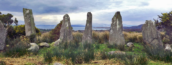
Ardgroom Stone Circle
The whole area is reknowned for the amount of prehistoric sites – one that is well worth the detour is Ardgroom Stone circle. The thing I like most about these circles in these locations is the way the view is so open all around them – you can see exactly what you were meant to see in all directions going back thousands of years. Yo ucan see just a small selection of the various megalithic sites in the area here.
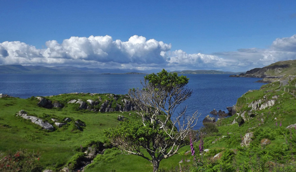
Mountains, Sea and Sky

Taking a rest before we hit “civilisation”
If you look at the 1901 census, you’ll see the following family names in quantity for Eyeries, Ardgroom and the surrounding area:
Connor, Crowley, Donovan, Driscoll, Dwyer, Hanley, Harrington, Healy, Houlahan, Kelly, Leahy, Leary, Lynch, McCarthy, Moriarty, Murphy, O’Neill, O’Connell, O’Shea, Sheehan and Sullivan.
Kenmare.
Time to hit the busy tourist metropolis (relatively!) of Kenmare. Kenmare manages to hold onto it’s charm while staying a top tourist destination on the start of the Ring of Kerry.
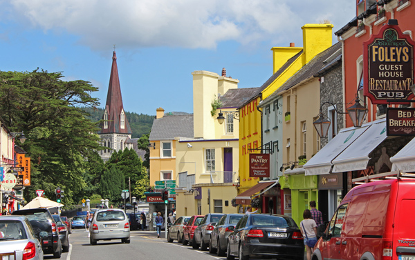
The town of Kenmare, County Kerry
We are firmly in County Kerry when we arrive in Kenmare – but still in a place that feels part of the Beara Peninsula – just a tamer part!
The town gets its name from the Irish “Ceann Mhara” – head of the sea – and was laid out by William Petty in 1670.
If you look at the 1901 census, you’ll see the following family names in quantity for Kenmare and the surrounding area:
Brennan, Coffey, Connell, Connor, Courtenay, Cronin, Downing, Doyle, Foley, Gaine, Harrington, Healy, Hegarty, Holland, Horgan, Kissane, Leary, Lovett, Lynch, Mahony, Maybury, McCarthy, Morris, Murphy, O’Shea, O’Sullivan, O’Connor, Orpen, Palmer, Quinlan, Randles, Rice, Sheehan, Sweeney, Wade and Warren.
When we arrived in Kenmare, I must say we were exhausted! On a map, the Beara section of the Wild Atlantic Way looks quite doable in a day – and I’m sure it is if you just keep driving! However, this place is all about stopping. Stopping to take in the smells, the sights, the voices, the sea and the mountains. I think I could probably spend about a month going nice and slowly around this most beautiful part of the world.
Join us on the next leg of our journey around the Wild Atlantic Way as we travel around the “Ring of Kerry” from Kenmare to Killorglin.


Only Plus Members can comment - Join Now
If you already have an account sign in here.