Module 2: Irish Land Divisions – What You Need to Know before Searching the Irish Records.
In this module we look at the Irish land division types you are likely to come across as you search the Irish records. We then illustrate how to use this information using our case-study family.

Module 2: Irish Land Divisions – What You Need to Know before Searching the Irish Records.
Table of Contents
In the last module:
- We gathered as many facts as possible about an Irish ancestor in their country of immigration. These “ancestor identifiers” would then make it easier to sort out the relevant Irish records for YOUR ancestor – especially if there were many people in a location with the same name and age.
- We introduced our Case-Study individual – Patrick Dolphin – and laid out all we knew about him and his family in a timeline format.
- We drew up a short-list of discovery questions by examining the gaps in this timeline. We will use these discovery questions to guide our exploration of the Irish records.
Before we make that leap back to the Irish records (that will be coming in the next module), we need to talk about Irish Land Divisions – and what you need to know about each type of Irish Land Division to make your Irish ancestry research more effective.
Introduction: What do you NEED to know about Irish Land Divisions?
Let’s start with the following two points:
Point 1: When your Irish ancestor (including our Patrick Dolphin) was asked where they came from in Ireland, they might reply with:
- The name of a “townland” and county if they lived in the open countryside – possibly mentioning a nearby village or town e.g. “Ballydavid (townland) near Loughrea (nearest town) in County Galway.”
OR
- The name of a village/town and county if they lived in a small urban area e.g. “Loughrea (town) in County Galway.” If they lived in the countryside, but near a major town or city, they may have just mentioned the name of that town or city.
OR
- The name of a street, city area and city if they lived in a large urban area e.g. “the Claddagh area of Galway city.”
They may have mentioned a “parish” from time to time, but would rarely mention a “province”, “barony”, “cantred”, “electoral division”, “poor law union” etc. However, many of these unmentioned types of divisions WERE used by various administrations in Ireland – and will sometimes feature in some Irish record sets.
Point 2: Which Irish land division you need to know about depends on which Irish record set you are examining.
Instead of me providing an exhaustive list of all types of Irish land divisions, their history and use (our lives are short enough as it is) – let’s instead cover the relevant land division types you need to know about based on the Irish record set you are examining. That should save us some time!
Over the rest of this module we will look at:
- A brief history and timeline of each type of land division in Ireland.
- Which land division types you need to know about before you can effectively read different types of Irish record.
Civil Land Divisions in Ireland – A History and Timeline.
Let’s start with a reminder just why “civil” land divisions exist anywhere in the world. It is primarily because of ownership, taxation and representation.
In the beginning, tribes of humans did not possess maps but relied on natural boundaries to signify the limits of their tribal lands. The natural boundaries included rivers, streams, sea-shores, mountain ranges etc.
As the land became enclosed for farming and taxation purposes – walls and ditches were built in addition to existing natural boundaries. Even so, these new enclosures often honoured existing tribal and natural boundaries.
All very interesting, but what has this to do with Irish records?
Well, if you consider the land divisions that exist in the place where you live now, you are probably thinking about how the land is presently organised. However, the boundaries of those land divisions around you probably fluctuated over the past hundred years as the population shifted, grew or declined.
As you examine the different types of Irish land divisions in the records – it is very useful to be aware of how the Irish land divisions you come across evolved over time. Some ancient Irish land divisions are still with us to this day (e.g. the “townland”) while many others have outlived their usefulness and become extinct. However, even those extinct Irish land divisions may be relevant when you come across older records relating to your Irish ancestors.
Here is a Brief History of Civil land divisions in Ireland and which you will come across in different sets of Irish records:
Pre 1180 AD (before the arrival of the Normans).
Irish lands outside the Hiberno-Norse cities of Dublin, Wexford, Waterford, Cork and Limerick were under the control of local Gaelic kings. Each of these small kingdoms was known as a “tuath” (pronounced “too-ah”). Each tuath was further divided and those sub-divisions were in the hands of individual extended families. These smallest divisions were probably around since the 600s and are the origin of the “Townland” system we know today.
The names given to these types of Tuath sub-divisions differed across the island of Ireland. Sometimes called “Baile” (pronounced Bal-ya) or “Ballyboes”, “Tates” and so on. Their title was only uniformly changed to “Townland” (baile is the Irish for town/home/place) in the 19th century. So, the word “townland” has nothing to do with a “town” – it could be more accurately anglicised as “homeland”.
Relevant land divisions from this time:
- The Townland. Townlands in Ireland were typically always viewed as the smallest administrative division. The townland is mentioned in most Irish historical land, church and civil records. When pressed, your Irish ancestor who lived in the countryside would have given their address as “townland name, name of nearest town/village, name of county” e,g, my own father came from “Foilnamuck (townland), Ballydehob (nearest village), County Cork (county)”. Any letter with that address would have successfully reached him there.
1180 AD – Mid 1600s
Following their arrival in Ireland in the late 1100s, the Normans established new types of Irish land divisions to award lands to their knights and to allow for subsequent taxation. They renamed many of the existing “Tuatha” as “Parishes”, and created “Cantreds” by bundling up groups of these Tuatha/Parishes – often anglicising existing Irish Tuatha names. There were about 180 Cantreds across the parts of the island that were held by the Normans.
The Norman administration also formed many of the Counties we know today by grouping these cantreds together. Each County had its own royal official – the Sheriff – who was responsible for governing the county.
With the onset of the Tudor conquest in Ireland in the 1500s, Parishes were formalised as land divisions (essentially becoming “Civil Parishes”) and the existing “Cantreds” were renamed as “Baronies”. As the conquest of Ireland continued into the 1600s, the divisions in Ireland increased from about 180 Cantreds to over 250 baronies – spread over 32 counties on the island of Ireland.
The smaller baronies often covered fertile land, while larger baronies extended over areas of poor land. The various plantations of settlers in Ireland were generally organised by Barony.
In summary, by the mid 1600s the hierarchy of Irish land divisions was as follows:
- The island was sub-divided into administrative counties – such as County Cork, County Kerry etc.
- Each County was sub-divided into Baronies.
- Each Barony was sub-divided into Civil Parishes.
- Each Civil Parish sub-divided into townlands.
By this point cities, towns and villages were also becoming prominent across Ireland.
Although “cantreds”, “baronies”, “tuatha” are mentioned above, they are not really relevant to the vast majority of genealogical records. The civil Irish land divisions you need to pay attention to are:
- The County. The island of Ireland was eventually divided into 32 administrative counties over a long period of time starting in the 1200s. The county remains with us today as the most relevant large land division.
- The Civil Parish. Each County was further divided into Parishes. Sometimes you hear about “church” vs. “civil” parishes. However, these only became distinct from one another as time went on. In the beginning both “church” and “civil” parishes had the same boundaries. You will see church parishes mentioned in church records and civil parishes in civil records (birth/marriage/death and land records). Annoyingly, the boundaries of different church parishes (e.g. Roman Catholic and Presbyterian) can vary in both name and extent. I’ll cover more on church boundaries later.
- The Townland. Each Parish was further divided into Townlands as I mentioned before.
- Towns and Cities. As time went on, towns were established and the cities grew in size. As you might imagine, it was easier to give your address using a street name for towns and cities rather than “townland”. So, for folks in the countryside or the outskirts of town, they typically had a “townland” as their most accurate place of residence, while someone in a town or a city provided a street name.
Now, lets move forward in time and look at some later types of civil Irish land divisions.
1838
Ireland was divided into “Poor Law Unions” (abbreviated as “PLUs” from now on) with the aim of helping paupers to receive poverty relief. Their boundaries were not related to existing civil parishes (more’s the pity). The Poor Law union was named after a major town within its environs – usually where the main workhouse was located.
PLUs are relevant for genealogical records for the following reason. When the Irish General Register Office was established in 1864 to administer Civil records – the earlier “Poor Law Unions” (PLUs) were renamed as “Superintendent Registrar Districts” (SRDs), and each of those further divided into “electoral divisions”.
As a result, SRDs have the same boundaries as PLUs. You will come across SRDs primarily in the birth/marriage/death vital records of the Irish civil records. As a result, you need to be aware in which SRD your ancestor’s townland/village/city was located to effectively use the Irish civil records.
I know, don’t worry – this just feels more complicated than it actually is. Remember, we’ll cover only what is necessary as we go forward – and I will give you examples using our Dolphin family in the case-study.
1898
The Local Government act of 1898 established a new system in Ireland for county-level administration that would be used for future council elections and census data gathering.
While earlier censuses were organised by county, civil parish and townland, the 1901 and 1911 were organised by county, a new unit called “District Electoral Division” (DED or ED) and townland. As a result, it is useful to know about DEDs if examining the Irish census records of 1901 and 1911.
1921
Finally, a quick note that the political entity of Northern Ireland was created in 1921 when the island of Ireland was partitioned into “Northern Ireland” (which remained part of the United Kingdom) and “Southern Ireland”.
Northern Ireland comprised the six counties of Derry/Londonderry, Antrim, Down, Armagh, Tyrone and Fermanagh. Southern Ireland went on to become the Irish Free State in 1922 and was subsequently declared The Republic of Ireland” in 1949.
New council boundaries and political constituencies were introduced in Northern Ireland following 1922. This led to a lessening of existing county names being used for administration purposes. The use of townland names also diminished in some of those counties with the introduction of official post codes in the 1970s (although there have been grass-roots initiatives to ensure the names of townlands are kept in regular use).
In the Republic of Ireland, the ancient county and provincial boundaries have remained intact – and townland names remain in use to such an extent that most of them can be found on modern Google Maps.
Right – that’s it for Civil Irish land divisions – let’s now move on to “Church Land Divisions”.
Church land divisions in Ireland – a History and Timeline.
You might wonder why we now complicate things by introducing “church” land divisions? The answer is simple. You need to know about “church parishes” for church records (baptisms, church marriages, burials).
Earlier we mentioned “civil parishes” which you will find on civil records (birth, marriage, death and most land records). Are church and civil parishes one and the same? Sometimes – but more often they have different names and different boundaries.
Time for a little background…
The Synod of Kells – 1152.
If we go back to 1100s Ireland – just prior to the arrival of the Normans – the island of Ireland was divided for the first time for ecumenical administration by the Roman church. This happened as a result of the Synod of Kells in 1152 and the island was divided into four “arch-dioceses” (or provinces) and thirty-six “dioceses”.
Each of “dioceses” was sub-divided into parishes. Arch-dioceses were run by archbishops, dioceses were run by bishops and parishes were run by priests. This dividing effectively started a parallel administration system to the civil one we mentioned above.
By the way, there was plenty of politics involved when introducing such a system into Ireland – and most dioceses corresponded to territories controlled by the major Irish septs with their chieftains nominating family members as bishops, nuns and church officials.
Mid 1500s – Dissolution of the Monasteries following the Reformation.
Subsequent to the reformation of the 1500s, the Roman Catholic church lost much of its land, control and power. Over the following decades the boundaries of roman catholic parishes were altered to take this new reality into account.
While the newly established protestant church – the “Church of Ireland” – initially followed the parish boundaries that existed from the 1100s, many RC parishes adopted new parish boundaries over time. In effect, this is when the confusing distinction between Irish “civil” and “church” parish boundaries was born. For genealogy purposes, it is useful to think of Church of Ireland parishes as synonymous with Civil parishes. It is then useful to more accurately rename “Church Parishes” as “Roman Catholic Church Parishes” for the rest of this training.
To add to that confusion, some of the later-arriving churches (Presbyterian etc.) established different administration boundaries again to reflect the population density of their own parishioners. In fact, Presbyterian churches do not have church parishes – but “denominational Presbyteries” that do not follow logical geographical boundaries. For the purposes of genealogy research, it is most useful to identify Presbyterian churches by the Civil (COI) parish in which they are located.
Why is this relevant to us?
Well, when you research a particular Irish ancestor it is important to know the religion into which they were born in Ireland. Once you have established that, you can then search for the baptismal, church marriage or death record in the appropriate church record set. It is then important to know within which civil parish your ancestral townland is located as well as within which church parish. Again, we will cover this later in our case-study using the Dolphin family.
OK – that’s it for my potted history and timeline of Civil Land Divisions and Church land divisions on the island of Ireland. Now, back to the main question that might be on your mind….
Which Irish civil and church land divisions do you need to know about to research the Irish records?
Let’s try to tie up this module by laying out the land divisions you need to know about when examining different types of Irish records.
Irish “civil” and “land” records – The types of land divisions you will come across in each.
Through the rest of this course, we will search the Irish record sets for more on Patrick Dolphin and his family. We will search both Irish civil records and Irish church records.
Here are the Land and Civil record sets we will be searching. I have listed the types of land divisions you will come across for each:
- Tithe Applotment Books – Land Records (1823-1837).
- County.
- Civil Parish.
- Townland/Street: Townland of residence, village name or street of residence. However, this was an agricultural tithe and so excluded many large town and city dwellers.
- Griffith’s Valuation Land Records (1847-1864).
- County.
- Civil Parish.
- Townland/Street: Townland of residence, village name or street of residence.
- Irish Civil Records (Birth, Marriage, Death) – from 1864 to present (non-RC marriages recorded from 1845).
- County.
- Superintendant Registrar’s District (SRDs) – these have the same names and boundaries of the earlier Poor Law Unions (PLUs). These are sometimes larger than a county.
- Registrar’s District – this is a subdivision of an SRD.
- Townland/Street: Townland of residence, village name or street of residence.
- Irish Census Records. Only the 1901 and 1911 census records still exist in their entirety.
- County.
- District Electoral Division (DED) (derived as subdivisions of already existing Poor Law Unions). Each county was divided into a number of DEDs for the purpose of census and electoral administration. DEDs were not used in census prior to 1901.
- Townland/Street: Townland of residence, village name or street of residence.
We will explore each of the Irish land division types shown above in an example at the end of this module.
Irish Church Records – The types of land divisions you will come across.
For each of the following church record sets, I have listed the types of land divisions you will come across:
Land Divisions mentioned in Irish Church Records (Baptism, Marriage, Burial) (e.g. in RC records):
- County
- Diocese
- Church Parish
- Sometimes you will also find Townland of residence mentioned (if in the open country) or town name/street of residence (if in a town or city). However, these details were entered at the discretion of the priest/chaplain who completed the record. Most church records are held in books organised by County and Diocese and each individual record entry often only contains the names of people involved in the ceremony.
Let’s explore each of the Irish land division types in the example below.
Irish Land Division types – A Practical Example.
We will now attempt to tie this Irish land divisions information together with a practical example. You may remember the details on the case-study I shared earlier. We gathered ancestor identifiers that told us Patrick Dolphin was born in a place called “Ballydavid” in County Galway.
Here is what we will do next:
- Find out if “Ballydavid” actually exists in County Galway and its location.
- Pull together all Land Division information related to Ballydavid together in a worksheet that I call a “Land Division Research Worksheet”. This “Land Division Research Worksheet” will keep all the land division information related to Ballydavid together in an easy to view format. We will keep this worksheet on-hand as we search various Civil, Land and Church records related to the Dolphin family and Ballydavid.
Here is an example of the worksheet containing the information we know so far – the question marks indicate information we would like to uncover before searching the Irish record sets:
| Land Division Type | Name | Where land division type is used. | Notes |
|---|---|---|---|
| Townland | Ballydavid | All civil, land, census and some church records. | |
| County | Galway | All civil, land, census and church records. | |
| Civil Parish | ???????????? | All civil and land records. | |
| RC Church Parish | ???????????? | All church records – Baptisms, Marriages and Burials/Deaths. | |
| RC Church Dioceses | ???????????? | All church records – Baptisms, Marriages and Burials/Deaths. | |
| Superintendent Registrar’s District (SRD). Same boundaries as earlier Poor Law union (PLU). | ???????????? | Civil vital records – Births, Marriages and Deaths. | |
| Registrar’s District (RD) Subdivision of SRDs. | ???????????? | Civil vital records – Births, Marriages and Deaths. | |
| District Electoral Division (DED – sometimes just ED). | ???????????? | Census records. | |
| Local Market Town | ???????????? | None – but useful to get your bearings for a townland. |
However, let’s hold our horses! We still need to check if Ballydavid is a real place. Is it a townland? A village? Is it even in County Galway?
Discovery question: Is “Ballydavid” in County Galway? If so, where?
Over the rest of this module I will introduce you to three very useful (and free) Irish ancestry tools. I will show you how I use each of these tools to uncover Irish land division information related to Ballydavid townland. My main aim is to show you that these tools are available, where to find them and how useful they might be in your future Irish ancestry research.
The sites/tools are:
- Johngrenham.com – A site developed and maintained by Irish genealogist John Grenham.
- SWilson.info – A site developed and maintained by Shane Wilson.
- Irishtownlands.ie – A community-developed and maintained site.
Each of these tools/sites have different uses and strengths. As we use each in our example (and you try them for yourself) you can make up your own mind as to their application and usefulness.
To discover more about Ballydavid we will start by using a tool contained on a website called “Johngrenham.com”. Pay attention to that name, as we will be using johngrenham.com a number of times during this course.
Tool 1: Johngrenham.com
To kick off our “Ballydavid discovery process” – and see if a place called Ballydavid exists in County Galway – we go to johngrenham.com where we will find the following:

See the “places” option at the top of the page? Click on that and you will get the following screen:

This is the screen we will use on johngrenham.com to see if Ballydavid exists and where we might find it. I continue by inputting Ballydavid in the placename box.
(A quick note – please remember to often use the * as a wildcard on this search page. Wildcards are very useful when you only have a portion of a placename e.g. you are looking for a “Gortna” something in County Galway. By entering Gortna* it will return all possibilities starting with “Gortna”).
For our example on Ballydavid, the following screen is returned:

I can see from the returned information that a number of Ballydavids exist – but there is only one in County Galway.
Let’s assume that this Ballydavid in County Galway belongs to our Patrick Dolphin – unless we disprove it further down the line.
Back to our “Land Division Research Worksheet”. We are now in a position to add more information related to this Ballydavid in County Galway. The additional information contained in the Row for Ballydavid on johngrenham.com provides the following extra information shown in red:
| Land Division Type | Name | Where land division type is used. | Notes |
|---|---|---|---|
| Townland | Ballydavid | All civil, land, census and some church records. | Information we started with |
| County | Galway | All civil, land, census and church records. | Information we started with |
| Civil Parish | Kilcooly | All civil and land records. | Obtained from Johngrenham.com |
| RC Church Parish | ???????????? | All church records – Baptisms, Marriages and Burials/Deaths. | |
| RC Church Dioceses | ???????????? | All church records – Baptisms, Marriages and Burials/Deaths. | |
| Superintendent Registrar’s District (SRD). Same boundaries as earlier Poor Law union (PLU). | Loughrea | Civil vital records – Births, Marriages and Deaths. | Obtained from Johngrenham.com |
| Registrar’s District (RD) Subdivision of SRDs. | Bullaun | Civil vital records – Births, Marriages and Deaths. | Obtained from Johngrenham.com |
| District Electoral Division (DED – sometimes just ED). | ???????????? | Census records. | |
| Local Market Town | ???????????? | None – but useful to get your bearings for a townland. |
OK – that is some more useful information – especially the “Civil Parish” and SRD (same as PLU) which are both used when examining Civil records. However, we still do not know which church parish Ballydavid is contained within – or the District Electoral Division (DED) which is used in the Irish census records.
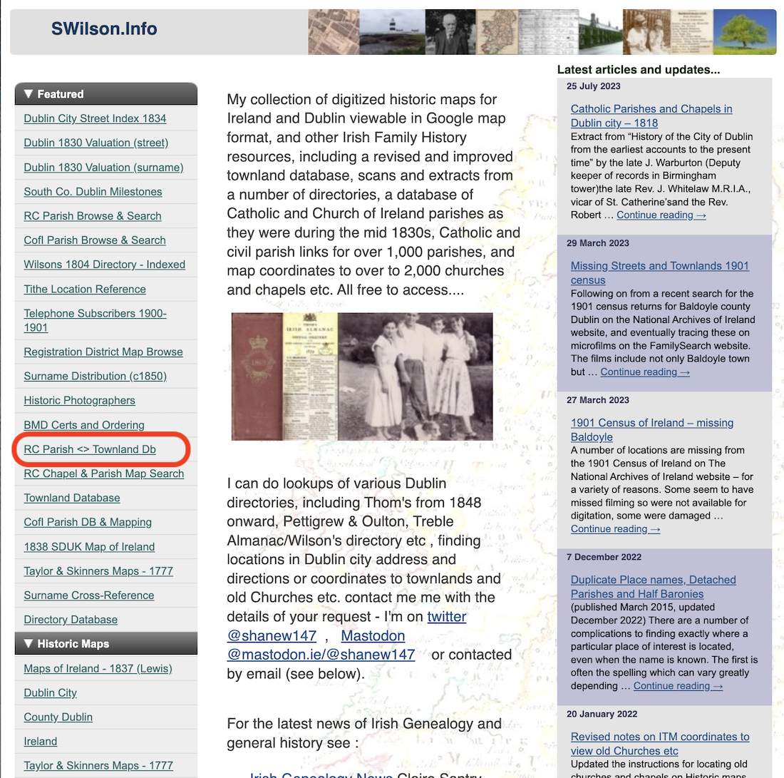
Tool 2: Swilson.info
To uncover the Church Parish related to the townland of Ballydavid, we will switch to another very useful tool contained on a different website. The website has been maintained by Shane Wilson for many years (i.e. it is stable) and can be found at: https://www.swilson.info/
Shane has created a site that is focused on Irish place names, maps and links to further useful resources for the Irish family history researcher.
For the purpose of this training module, we are interested in just using this site to uncover the Church Parish in which Ballydavid townland, County Galway is located.
In this case, we already know that Patrick Dolphin was Roman Catholic, so for the purposes of this demonstration we will use the tool outlined below in red – the “RC Parish to Townland Database”:
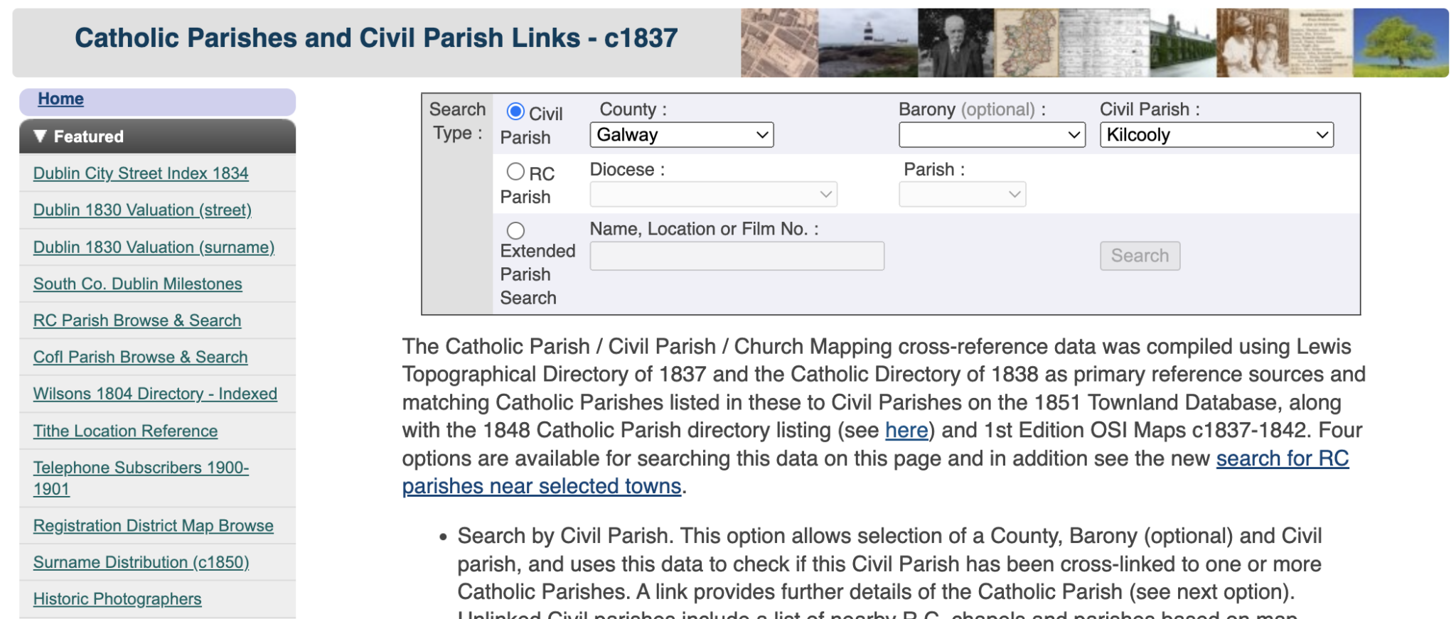
When you click on “RC Parish<>Townland Db” you will see the following screen. We already know the relevant County (Galway) and Civil Parish name (Kilcooly) – so we click on the Civil Parish radio button option and select County as Galway and Civil Parish as Kilcooly.
And the following screen is returned:
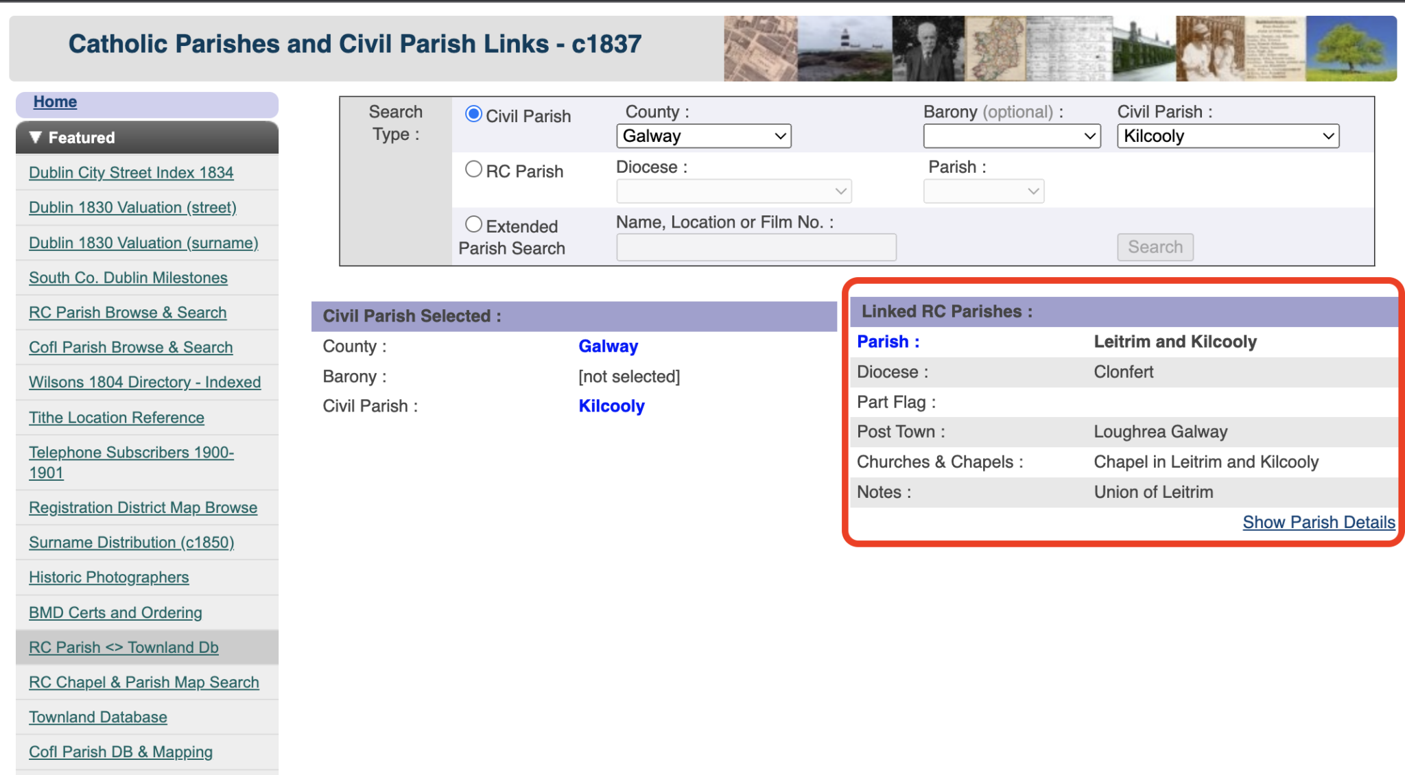
Pay attention to the information I have outlines with a red box. This tells us that:
- The relevant Roman Catholic Parish for Kilcooly Civil parish is “Leitrim and Kilcooly”.
- It is in the RC Diocese of Clonfert.
- The local market town for the parish is Loughrea in County Galway.
- Event the local RC chapels that were in place around 1837 are named.
Finally, notice the small link at the bottom right of the red box: “Show Parish Details”. Click on that for more useful information as follows:
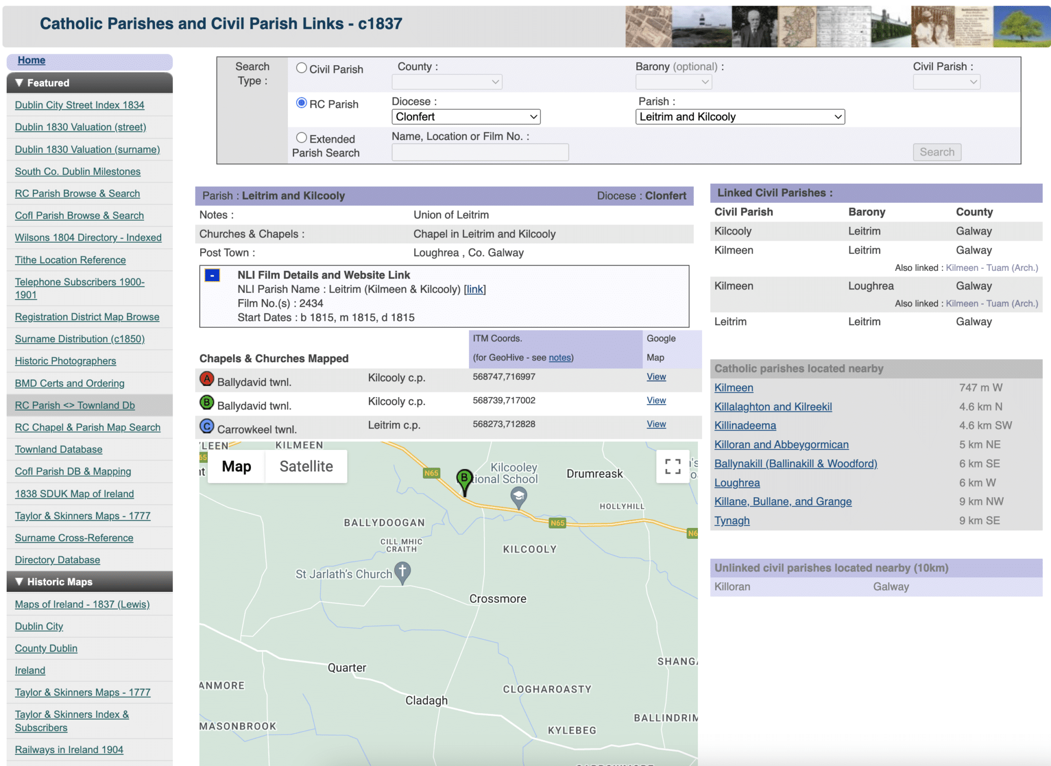
This gives you a lot of additional RC parish information – specifically the actual locations of chapels within Google Maps, nearby Catholic parishes etc.
So, for the purposes of our case-study example – let’s get that “Irish Land Divisions Research Worksheet” out and add some more information shown below in red:
| Land Division Type | Name | Where land division type is used. | Notes |
|---|---|---|---|
| Townland | Ballydavid | All civil, land, census and some church records. | Information we started with |
| County | Galway | All civil, land, census and church records. | Information we started with |
| Civil Parish | Kilcooly | All civil and land records. | Obtained from Johngrenham.com |
| RC Church Parish | Leitrim and Kilcooly | All church records – Baptisms, Marriages and Burials/Deaths. | Obtained from SWilson.info |
| RC Church Dioceses | Clonfert | All church records – Baptisms, Marriages and Burials/Deaths. | Obtained from SWilson.info |
| Superintendent Registrar’s District (SRD). Same boundaries as earlier Poor Law union (PLU). | Loughrea | Civil vital records – Births, Marriages and Deaths. | Obtained from Johngrenham.com |
| Registrar’s District (RD) Subdivision of SRDs. | Bullaun | Civil vital records – Births, Marriages and Deaths. | Obtained from Johngrenham.com |
| District Electoral Division (DED – sometimes just ED). | ???????????? | Census records. | |
| Local Market Town | Loughrea | None – but useful to get your bearings for a townland. | Obtained from SWilson.info |
We now have nearly all the Land Division information we need for Ballydavid townland – all we are missing is the District Electoral Division (DED or ED) name for the census records.
To uncover the DED that Ballydavid is contained within, we will use the third useful website -Townlands.ie.
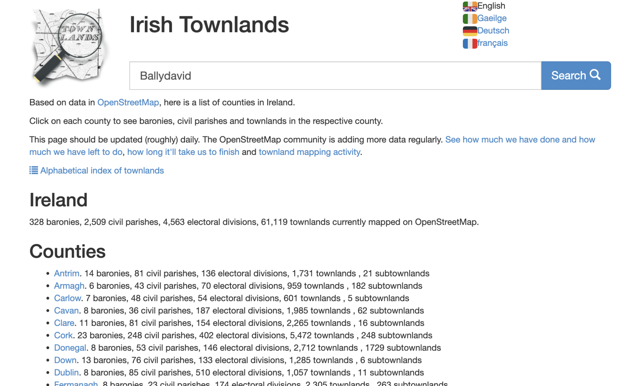
Tool 3: Townlands.ie
So far we have used Johngrenham.com and SWilson.info to help complete the land division information in our “Irish Land Division Research Worksheet”. Now, we move on to the third tool – Townlands.ie – to quickly find out just which “DED” (or “ED” – used for Irish census records) holds our Ballydavid townland.
Go to the Irish townlands site and you will see the following screen – let’s enter the townland name of “Ballydavid” and see what that returns when we click the search button:
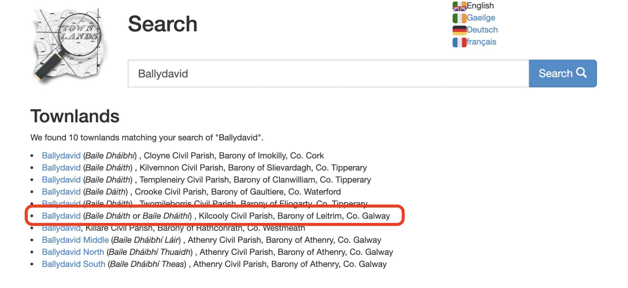
In this case a number of Townlands with “Ballydavid” in their name are returned:

An important point: You might remember that when we did the same type of search on Johngrenham.com that only one Ballydavid townland was returned in County Galway. Using this tool, we see that four are returned: Ballydavid, Ballydavid Middle, Ballydavid North and Ballydavid South – all in County Galway. This shows the merit of using different tools to uncover information in a slightly different manner as search engines can be different, your prompt might work well by default on one search engine but not on another etc.
I now see that if I do not find clues of the Dolphin presence in “Ballydavid” in Kilcooly Civil Parish, then I may need to move my search on to the other three Ballydavids listed here!
However, let’s progress with the Ballydavid boxed in red below:
When I click on the “Ballydavid” link inside the red box above, the following screen is returned:
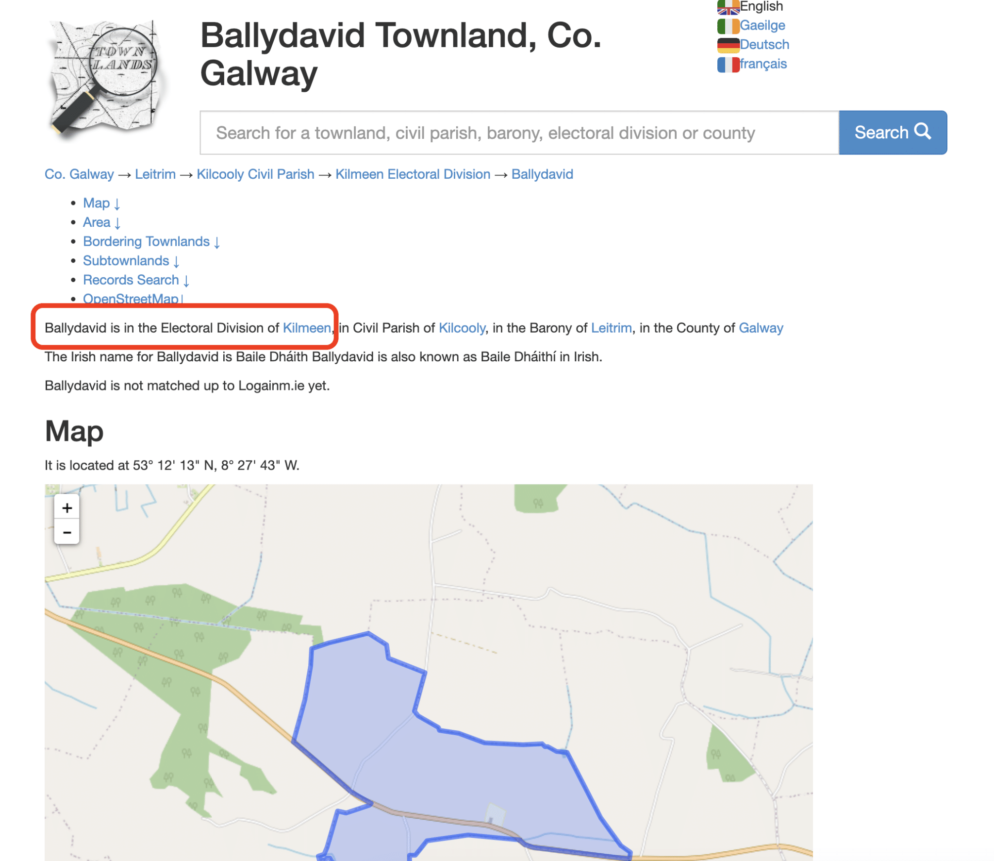
The information provided on this Ballydavid include the “ED” (also called DED) which is Kilmeen ED. This is the main information we are seeking. Townlands.ie also shows some very useful “surrounding townlands” information and mapping.
An Important point: You might notice that Townlands.ie also provided us with the name of the Civil Parish for Ballydavid – the information we previously gathered from Johngrenham.com. This shows there is some overlap between these three tools I am using – but I do suggest that you use and test all three tools – you will discover your own favourites over time.
Let’s go back to our “Irish Land Division Research Worksheet” and fill in that final piece of information:
| Land Division Type | Name | Where land division type is used. | Notes |
|---|---|---|---|
| Townland | Ballydavid | All civil, land, census and some church records. | Information we started with |
| County | Galway | All civil, land, census and church records. | Information we started with |
| Civil Parish | Kilcooly | All civil and land records. | Obtained from Johngrenham.com |
| RC Church Parish | Leitrim and Kilcooly | All church records – Baptisms, Marriages and Burials/Deaths. | Obtained from SWilson.info |
| RC Church Dioceses | Clonfert | All church records – Baptisms, Marriages and Burials/Deaths. | Obtained from SWilson.info |
| Superintendent Registrar’s District (SRD). Same boundaries as earlier Poor Law union (PLU). | Loughrea | Civil vital records – Births, Marriages and Deaths. | Obtained from Johngrenham.com |
| Registrar’s District (RD) Subdivision of SRDs. | Bullaun | Civil vital records – Births, Marriages and Deaths. | Obtained from Johngrenham.com |
| District Electoral Division (DED – sometimes just ED). | Kilmeen | Census records. | Obtained from townlands.ie |
| Local Market Town | Loughrea | None – but useful to get your bearings for a townland. | Obtained from SWilson.info |
We will use this worksheet of land divisions related to the townland of Ballydavid as we go forward with our case-study over the following modules of this course.
In Conclusion.
In summary, the most useful things you need to know before searching for an Irish ancestor are:
- County of residence.
- Townland (or village/city/town) of residence.
- Religion into which your Irish ancestor was born.
Once you have these, you can establish the correct church, civil and land record sets to examine. Probably the trickiest thing is correlating the boundaries of church parishes and civil parishes or SRDs with civil parishes and counties. I showed you how to gather all the relevant Irish land Division information into one place for a townland using the “Irish Land Division Research Worksheet” and how to fill in that worksheet using the three very useful tools/sites of Johngrenham.com, SWilson.info and townlands.ie
I hope that this Irish land division “primer” provides an appreciation of how the different land divisions in Ireland evolved over time and which ones you need to pay special attention to as you examine the Irish record sets.
Try For Yourself.
Before you move onto the next module, I suggest that you:
- Replicate all of the results I have shown above in the “Irish Land Division Research Worksheet”. This will familiarise you with the tools I mention and encourage you to explore them further on your own.
What’s Next?
Right, that’s it for this module – in the next module we start our tour of the most accessible and commonly-used Irish Record sets – we look at what type of information is available in each record set and where to find them.
Only Plus Members can comment - Join Now
If you already have an account sign in here.